
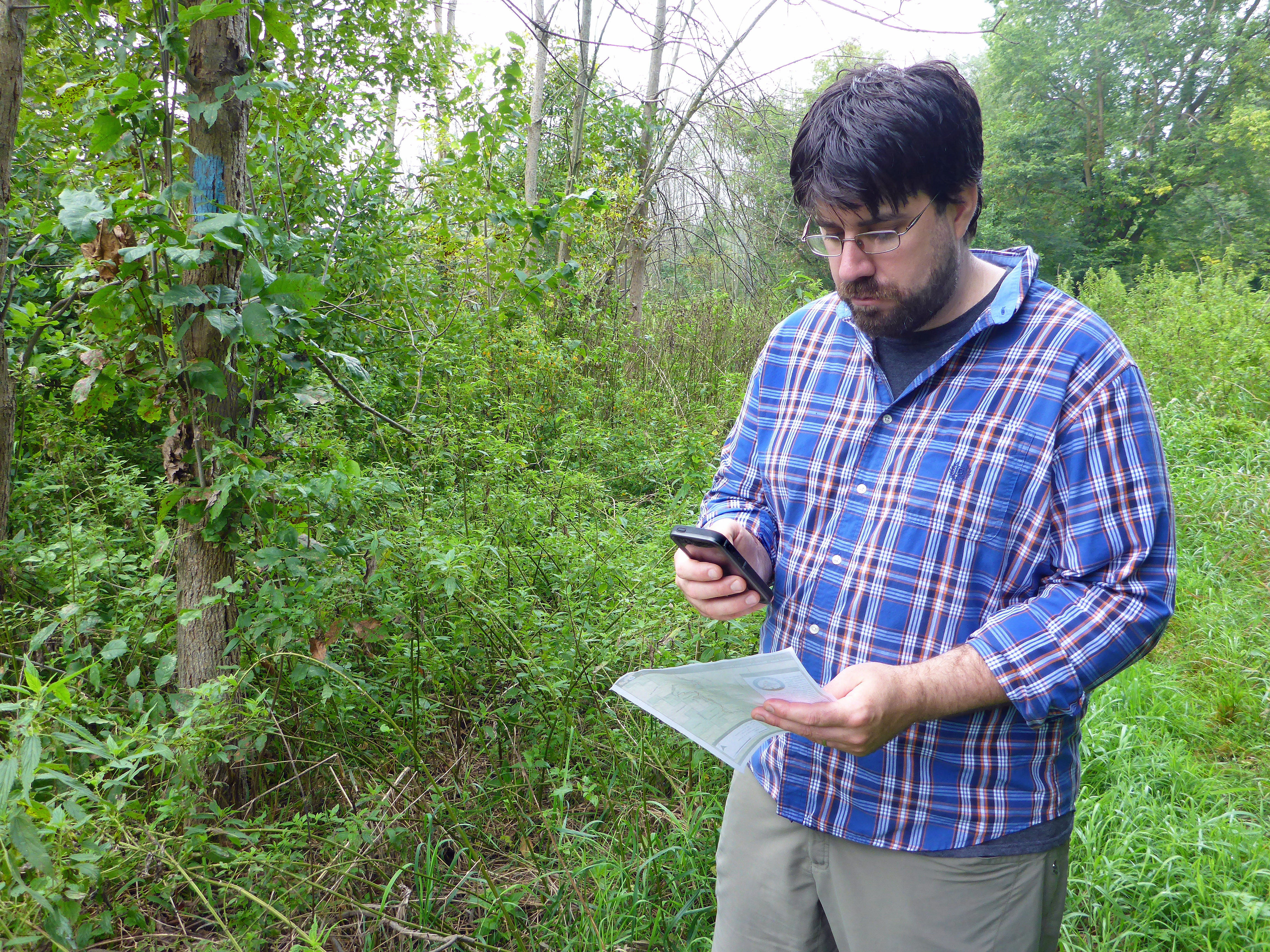
Matt Rowbotham, the cartographer for the North Country Trail Association, stops along the trail (marked by blue blazes on trees) to compare information on a paper map and the new digital map for the trail. Photo by Howard Meyerson
By Howard Meyerson
Experienced hikers know a map and compass are two essential items to pack on any trek. But, what about electronic navigation: using GPS or the new digital navigation apps that can be downloaded into a mobile device such as a smartphone?
Matt Rowbotham is a strong proponent for the latter, but the 36-year-old cartographer for the North Country National Scenic Trail is unequivocal about the former.
“You should never go on a hike without a good map as a backup,” Rowbotham said, having hiked sections of the NCT in all seven states. “Digital stuff can fail; your batteries can fail; your service can fail. The best practice is always to carry a map when headed off into the woods.”
Having said that, Rowbotham is very enthusiastic about a new series of smart-maps he is producing for the North Country Trail Association, the national nonprofit headquartered in Lowell that, among other things, supports and coordinates the work of its chapter members who are building the 4,600-mile footpath from North Dakota and New York.
“We’ve added geospatial awareness to our (downloadable) PDF maps,” Rowbotham explained when we recently met for a demonstration. “The technology has been around for five or six years and people thought ‘Wow. This is really useful’ to be able to pull a (digital) PDF map up (on a computer) and measure mileage between coordinates. But the real usefulness exploded when we found you can put them (PDFs) on mobile devices and actually track your location, record way points and record tracks (your travel path).”
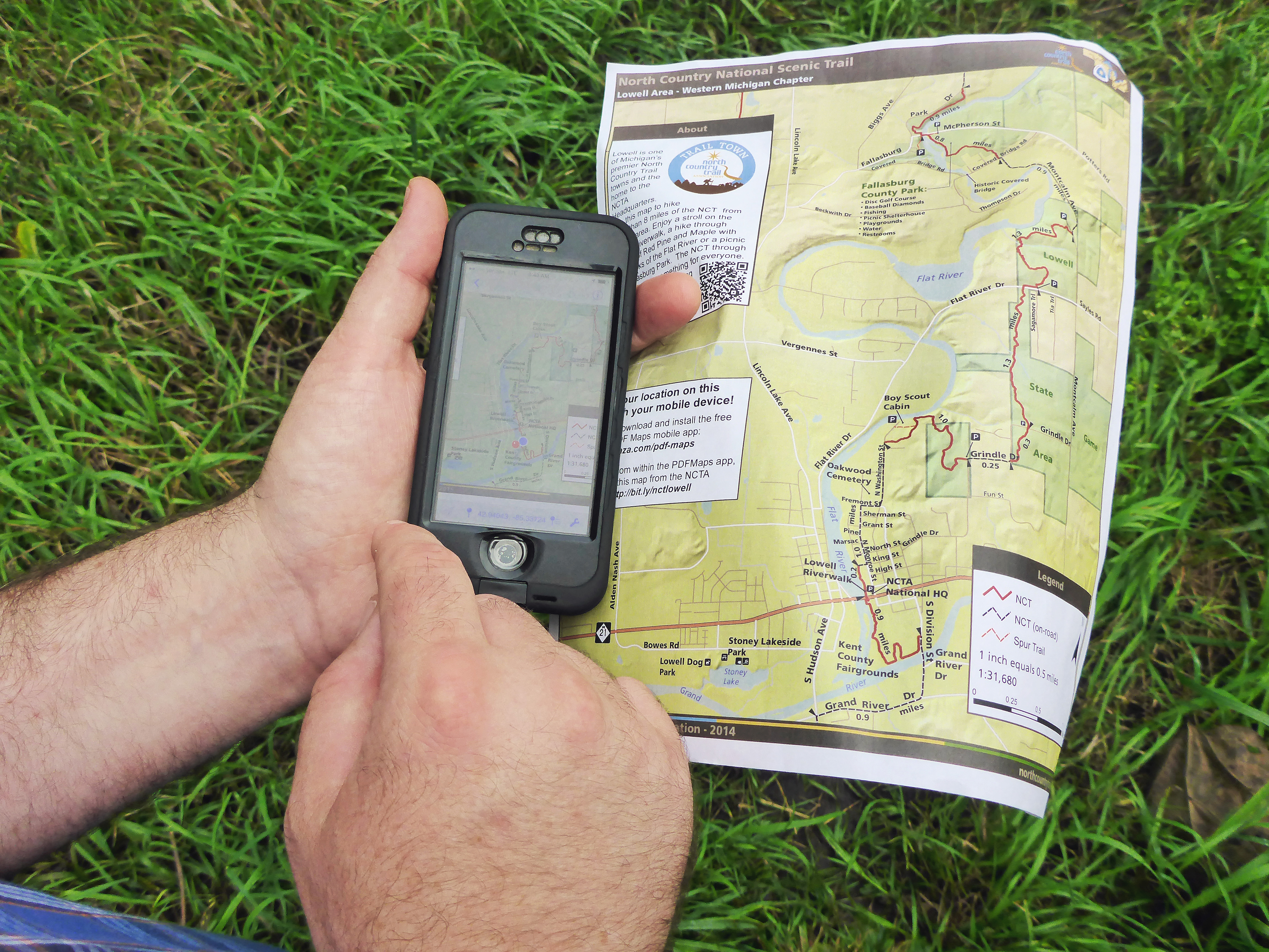
While paper maps show the trail and surroundings, a new digital map app developed by Matt Rowbotham and the North Country Trail Association also shows a hikers position and progress on the trail. Photo by Howard Meyerson
Geospatial Awareness
“Geospatial awareness,” Rowbotham explained, is a fancy term for the digital technology that embeds GPS coordinates on what otherwise would be a plain map of the trail. Print it out and that is what you have. But when a geospatial PDF map is downloaded on a smart phone with GPS, the hiker can see just where they are on the North Country Trail — as well as their progress in real time.
“Every map we produce from now on will be geospatial PDFs,” Rowbotham said.
“This year, we will be launching a huge number of the maps. We hope to have the entire state of Michigan done by this winter. That’s what we are moving to. Rather than buy a paper map at our office, we will be offering these digital downloads that people can print at home (or use on mobile devices). All of our existing Minnesota maps are this way now, and an assortment of hand-out maps all over the trail.”
An entire set of NCT geospatial maps for Michigan, about 1,150 miles of trail, will cost from $75-$80 once the work is done. Currently, they are $100 and are not geospatial, Rowbotham said. The software to make them work can be downloaded for free at avenza.com/pdf-maps.
The maps are available on the NCTA website at bit.ly/nctlowell.
‘Live Public Map’
Long-distance hikers also have another great digital option for seeing their location and progress on the NCT. Rowbotham calls it the “live public map.”
It is free and found online at: northcountrytrail.org/trail/maps/. It too can be used on a mobile device.
The live map has a database behind it that allows hikers to see nearby lakes, camping spots, parking areas, points of interest and more.
“It’s a nice tool,” Rowbotham said. “It’s like Google Maps on steroids. It’s available for the entire state of Michigan. We had a guy last fall who hiked the entire Lower Peninsula using it.”
One caution with the live map, when used on a cell phone, is they require a cell signal. Signal coverage is spotty in parts of Michigan, particularly in the Upper Peninsula. That is where the geospatial maps shine.
“The reason those (geospatial PDF maps) are so exciting is that you can download them to your phone and lose a data signal and they still work.”
Hikers who rely on digital navigation have to be vigilant about charging their batteries, even carrying a spare or solar charger on a long trek. The best digital apps are of little use once the power dies.
Of course hikers can always purchase a set of paper maps and work on map and compass skills. Those are available from NCT also. Each topographic map showing the trail costs $6.95 and covers 120 miles. They are available at the NCTA office in Lowell or online at northcountrytrail.org.
__________________________
Appears in MLive Media Group newspapers and on MLive Outdoors.
